Ecological Risk Assessment
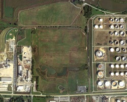
Delineation of Constituents of Potential Ecological Concern in a Salt Marsh for Atlantic City Sewerage Company, at a Former Waste Water Treatment Plant Grit Disposal Area in Atlantic City, NJ
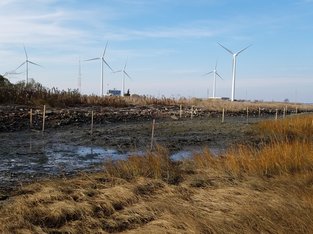
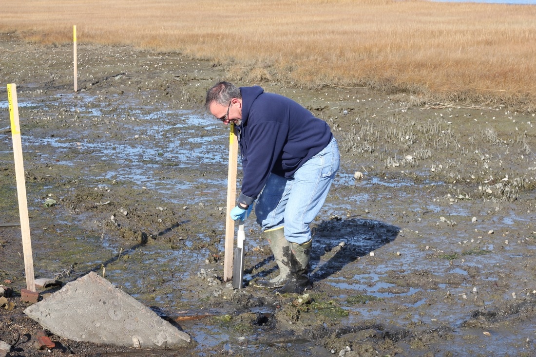
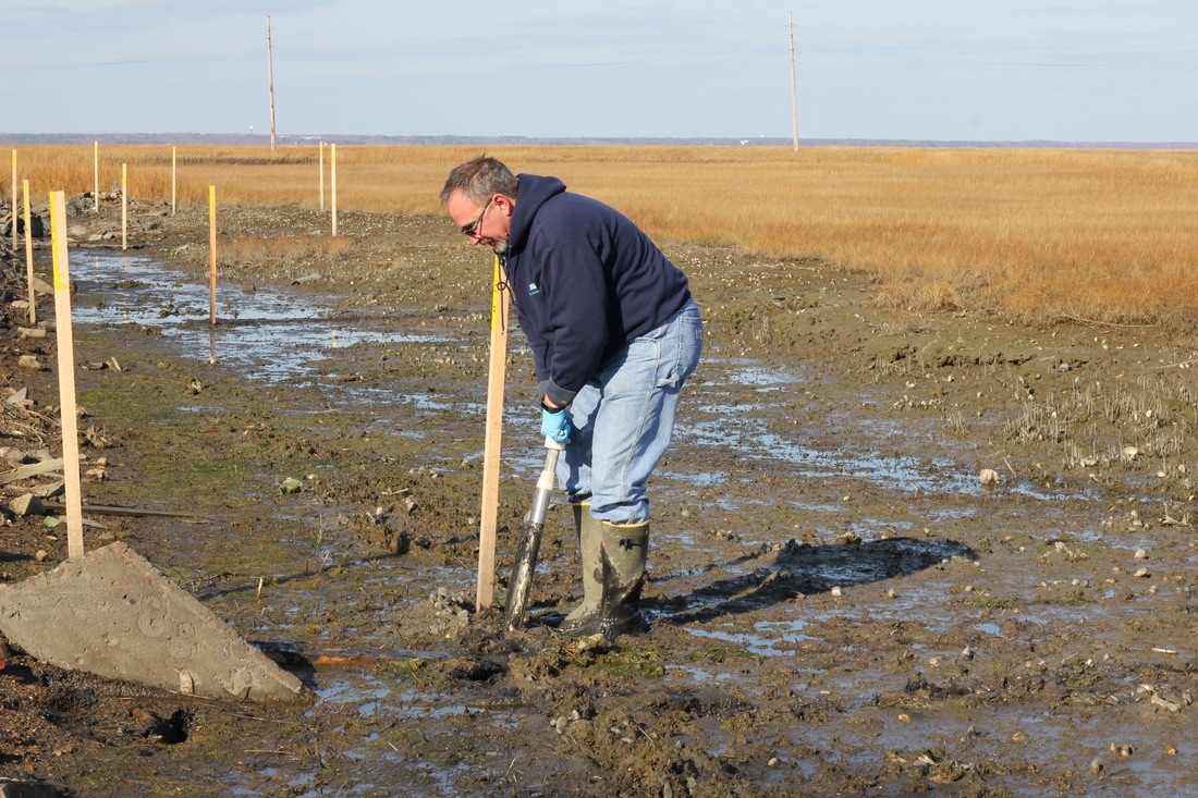
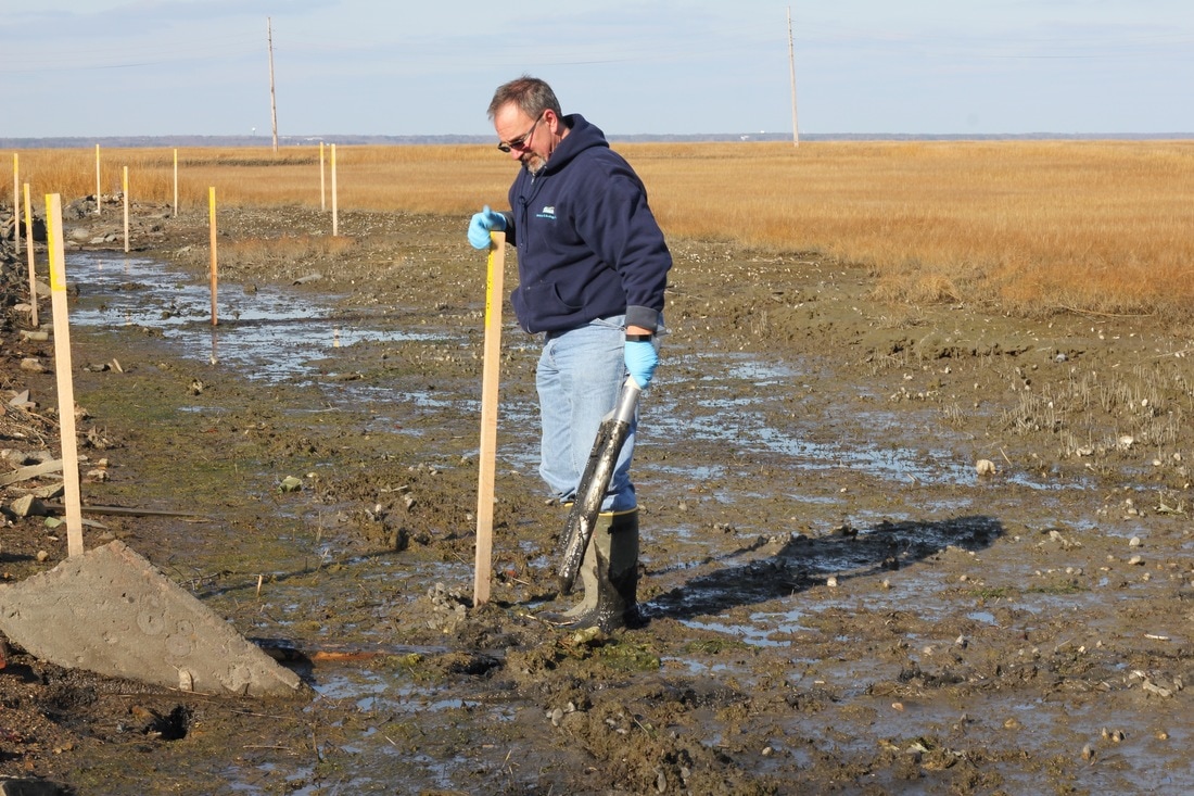
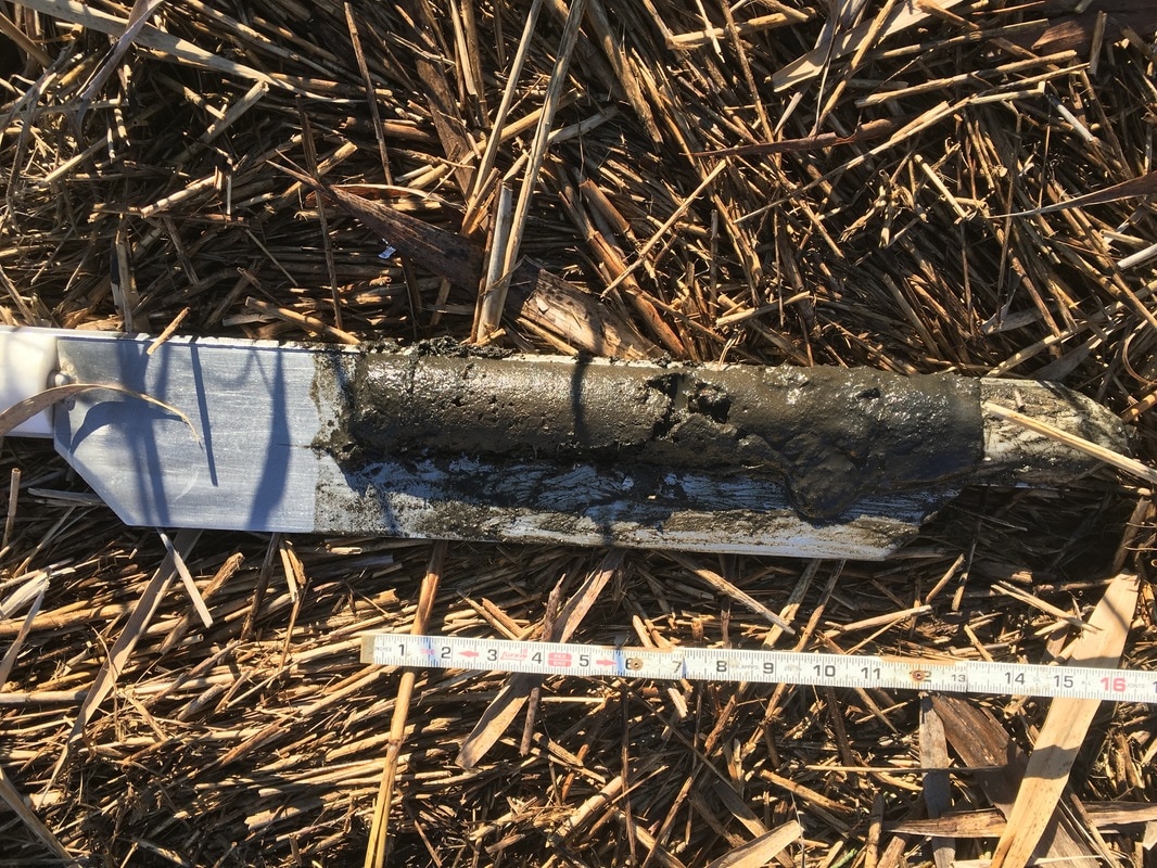
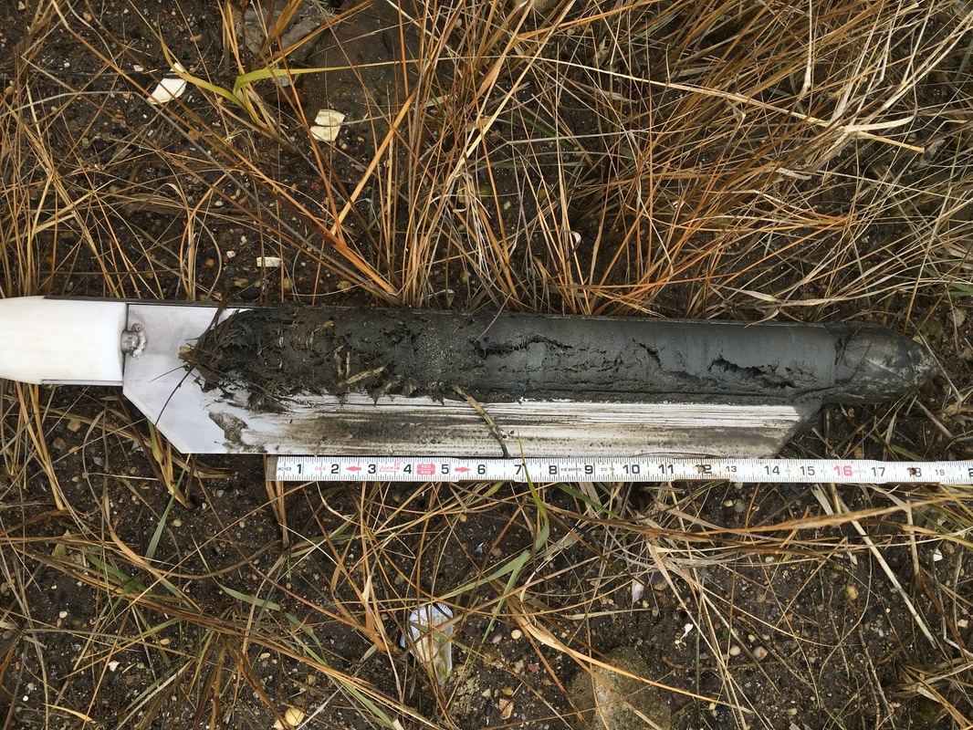
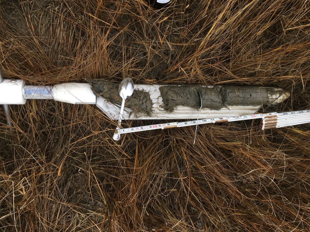
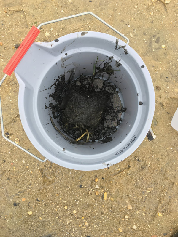
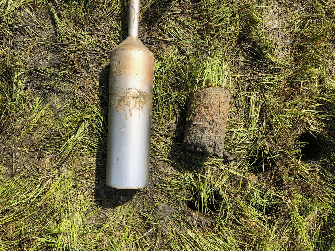
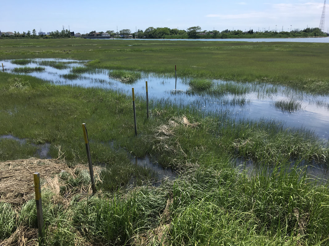
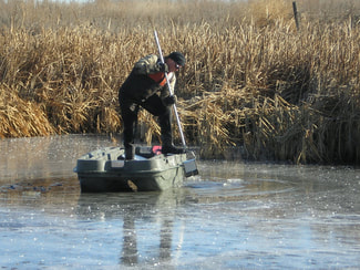
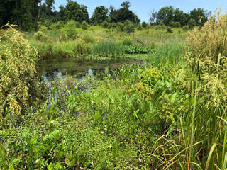
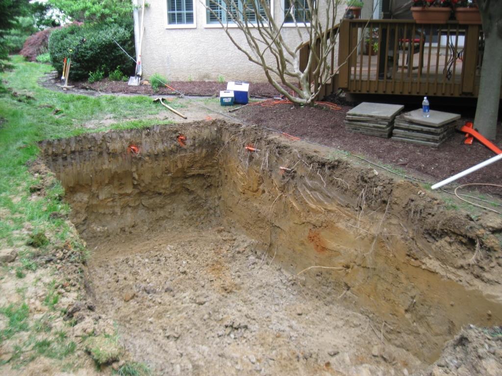
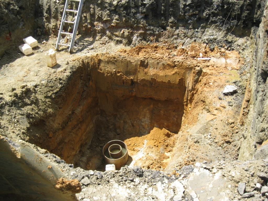
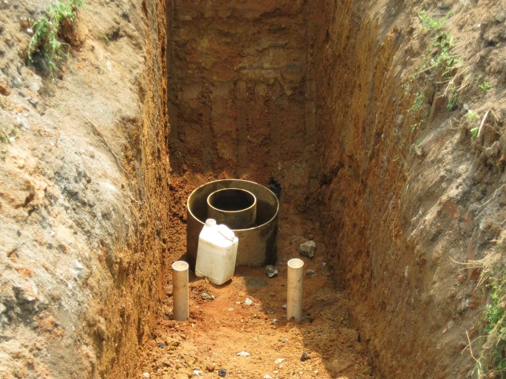
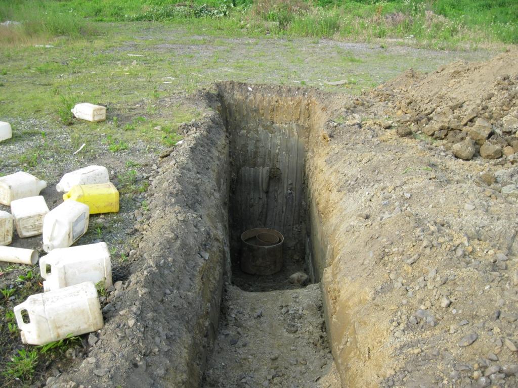
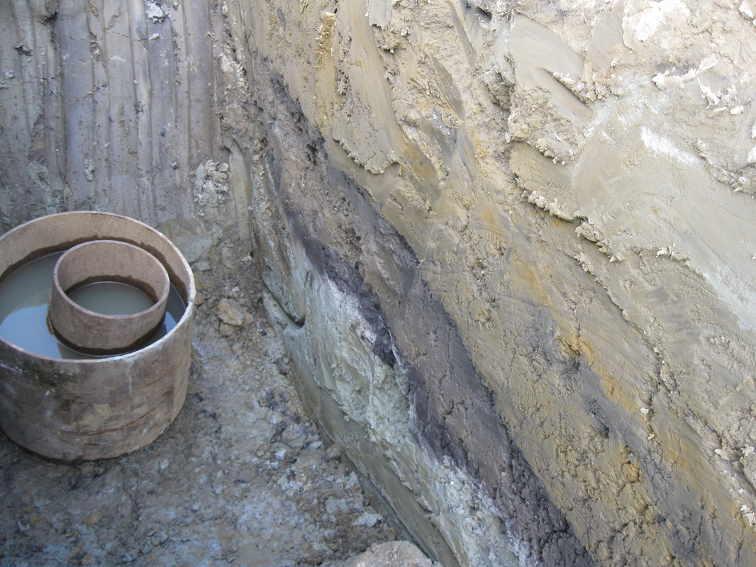
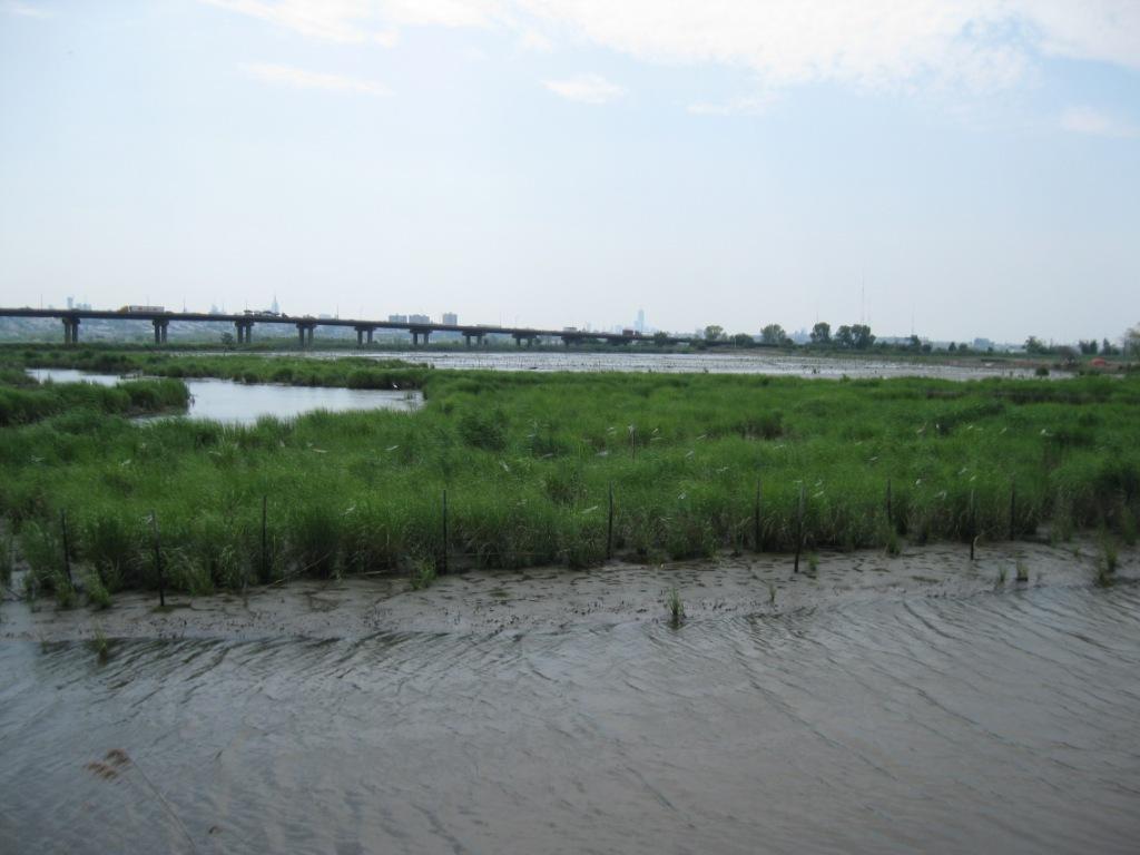
The first task for addressing potential ecological risks associated with the former treatment plant grit disposal area was to delineate the nature and extent of constituents above ecological risk screening values. W&E is completed that work in 2018. W&E used a unique sampling method to conduct the delineation work. W&E used a Russian Peat Corer (pictured below). The corer allowed us to collect an almost completely undisturbed/uncompressed core from the salt marsh, so that we could collect and analyze depth discrete samples. Those data were assured to have results that could reliably be used to understand the concentrations of constituents at depth.
The first task for addressing potential ecological risks associated with the former treatment plant grit disposal area was to delineate the nature and extent of constituents above ecological risk screening values. W&E is completed that work in 2018. W&E used a unique sampling method to conduct the delineation work. W&E used a Russian Peat Corer (pictured below). The corer allowed us to collect an almost completely undisturbed/uncompressed core from the salt marsh, so that we could collect and analyze depth discrete samples. Those data were assured to have results that could reliably be used to understand the concentrations of constituents at depth.
Ecological Risk Assessment, Atlantic City Sewerage Company, Former Waste Water Treatment Plant Grit Disposal Area, Atlantic City, NJ
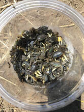
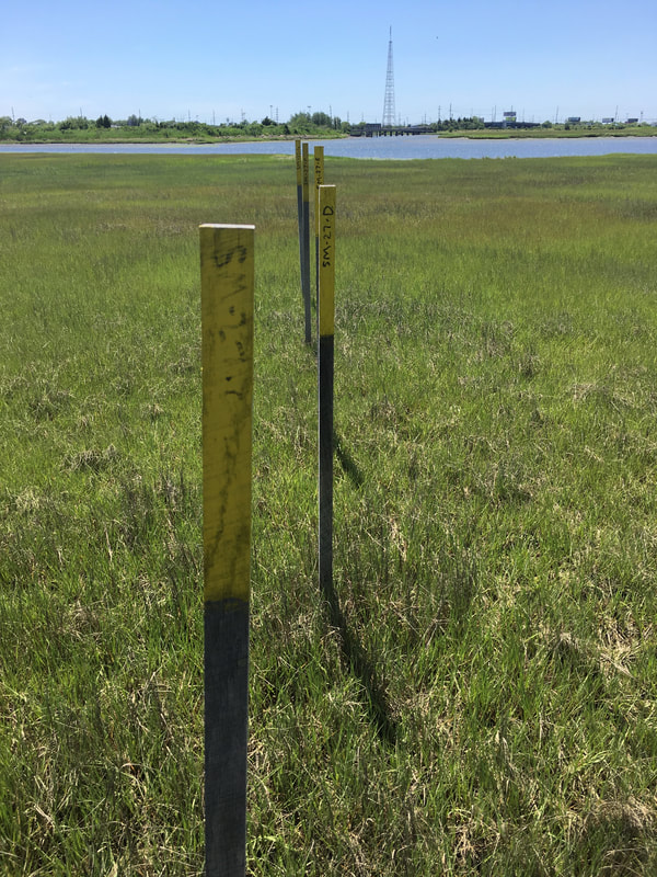
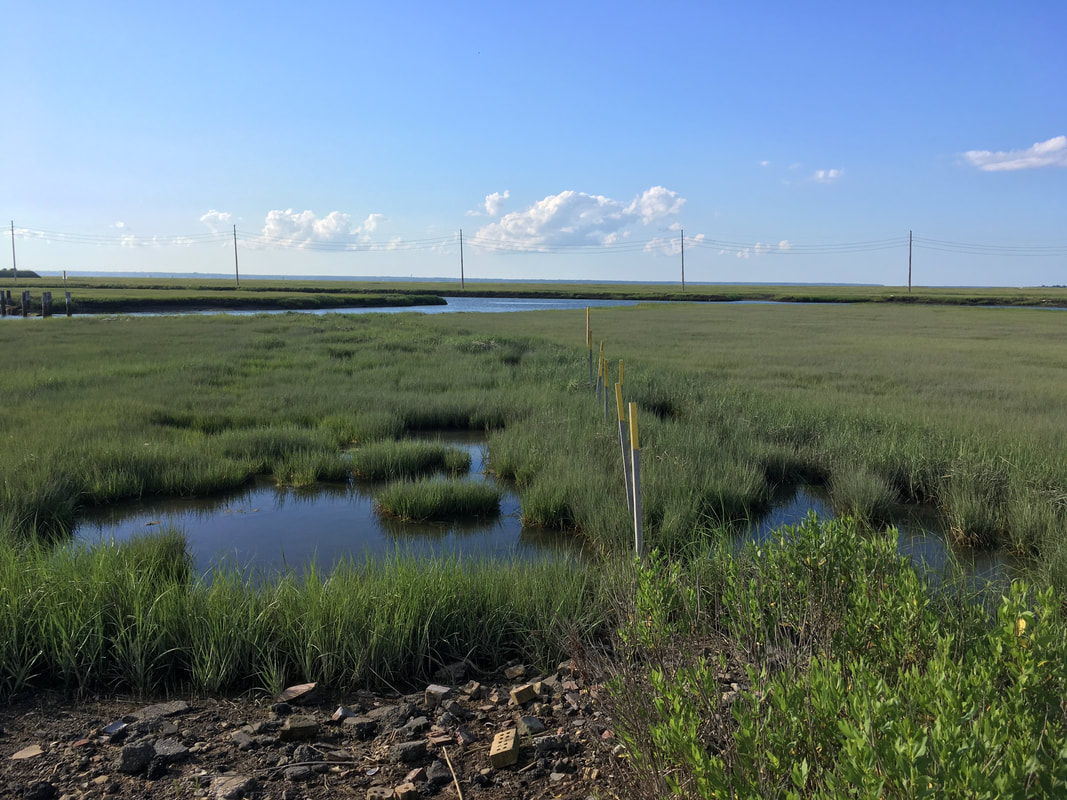
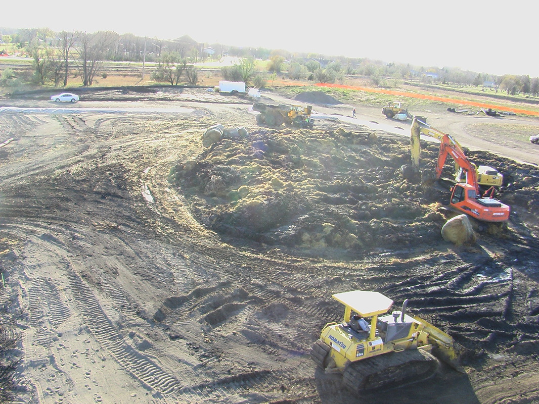
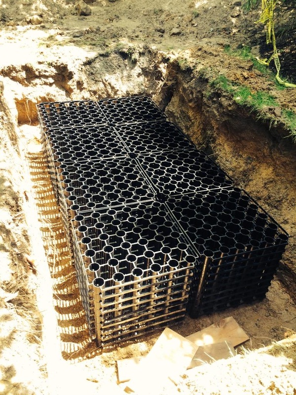
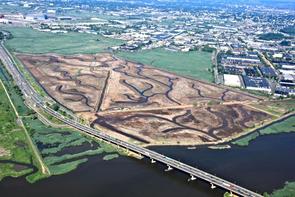
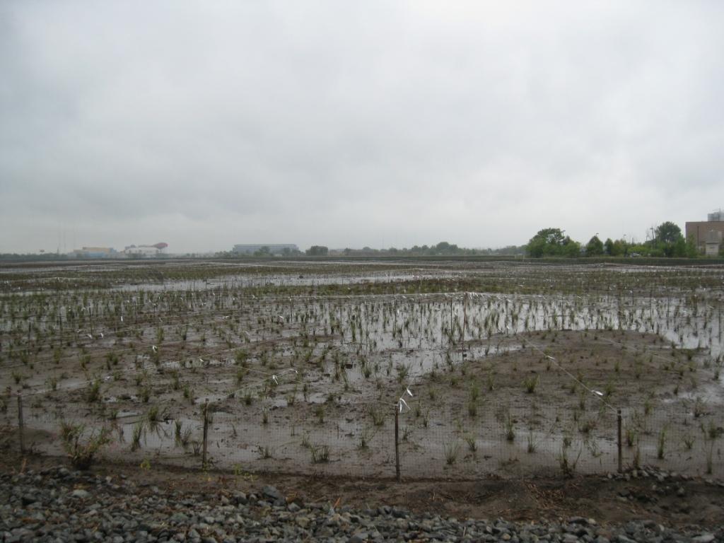
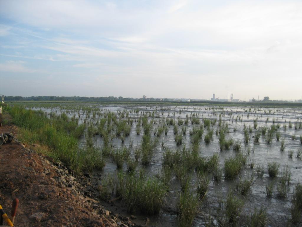
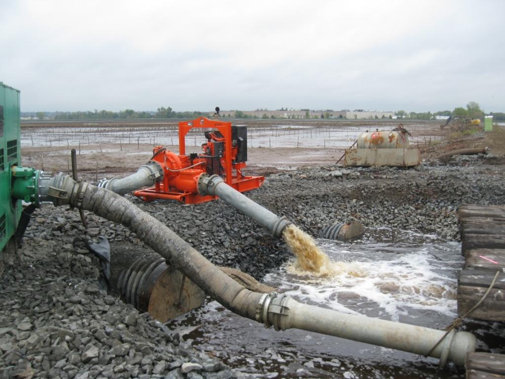
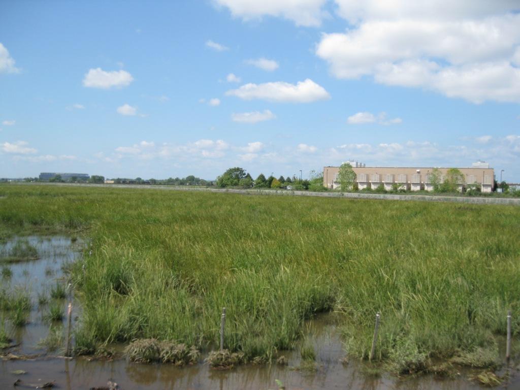
After the delineation work was completed, the extent of potentially impaired sediment that would require remediation utilizing salt marsh sediment screening values was so extensive that W&E recommended going to the expense of performing a Ecological Risk Assessment for the purpose of developing site-specific risk-based remediation values for the constituents found in the salt marsh and channel sediment. The ERA was designed after the often used sediment quality triad method, with the addition of two other lines of evidence (whole body concentrations in Uca pugnax (fiddler crab) and concentrations of acid volatile sulfides in sediment samples). The risk-based concentrations for a number of site-related constituents of ecological concern were accepted by New Jersey Department of Environmental Protection as Alternative Remediation Standards that were deemed to be protective of ecological receptors at this site. Those risk-based values saved the site owner well in excess of $2 million in remediation costs, when compared to utilizing New Jersey's ecological screening value as a cleanup concentration for the site. The remediation and restoration designs were completed in 2021 and permits were obtained from US Army Corps of Engineers and New Jersey and construction began in spring 2023.
After the delineation work was completed, the extent of potentially impaired sediment that would require remediation utilizing salt marsh sediment screening values was so extensive that W&E recommended going to the expense of performing a Ecological Risk Assessment for the purpose of developing site-specific risk-based remediation values for the constituents found in the salt marsh and channel sediment. The ERA was designed after the often used sediment quality triad method, with the addition of two other lines of evidence (whole body concentrations in Uca pugnax (fiddler crab) and concentrations of acid volatile sulfides in sediment samples). The risk-based concentrations for a number of site-related constituents of ecological concern were accepted by New Jersey Department of Environmental Protection as Alternative Remediation Standards that were deemed to be protective of ecological receptors at this site. Those risk-based values saved the site owner well in excess of $2 million in remediation costs, when compared to utilizing New Jersey's ecological screening value as a cleanup concentration for the site. The remediation and restoration designs were completed in 2021 and permits were obtained from US Army Corps of Engineers and New Jersey and construction began in spring 2023.

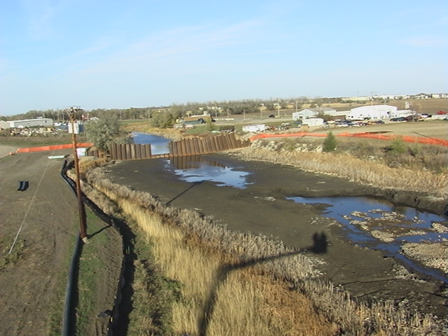
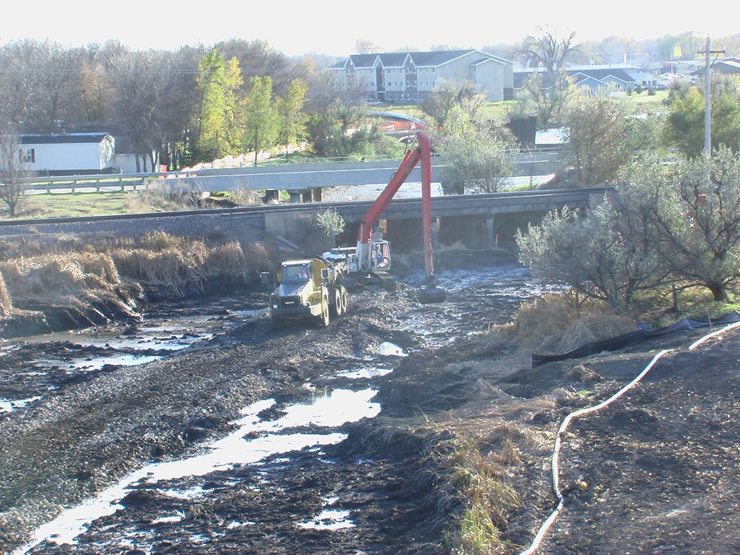
Ecological Risk Assessment, NorthWestern Energy, Former Aberdeen Manufactured Gas Plant Site, Aberdeen, SD
The first task for addressing potential ecological risks associated with the former Aberdeen Manufactured Gas Plant was to assess the available historic analytical data collected from the creek (sediment, and surface water) to determine whether there were any potential ecological risks that could be associated with the concentrations of constituents detected by comparing those concentrations to screening values. Based on the assessment, a strategy was developed for some limited additional investigation to delineate the limits of impacted sediments in Moccasin Creek, in the vicinity of the historic discharge from the site. Sediment was sampled and analyses were limited to site related constituents (PAHs). That work was conducted such that the data collected could be used later to determine the extent of sediment removal that was necessary. The sampling plan included the use of PAH field screening kits (immuno-assay) that bracketed ecological screening criteria to limit the number of samples that would need to be sent to a laboratory for analysis. All of the samples that were analyzed for PAHs were also analyzed for total organic carbon so that the screening values could be normalized to the organic carbon in the creek sediment.
The results from those samples were compared to sediment screening values and a cost estimate was prepared for removing sediments that were presumed to be impacted based on those screening values. Based on using the screening values the remediation was estimate to be about $7,500,000 (2005). W&E advised NorthWestern Energy that an ecological risk assessment could be conducted to develop a risk based cleanup concentration and may reduce the amount of sediment requiring remediation. W&E then conducted an ecological risk assessment using the sediment quality triad approach. Our study found that employing this approach resulted in a sediment cleanup value over an order of magnitude higher than the sediment screening value that was used to develop the original cost estimate. The findings from the ecological risk assessment were presented to South Dakota Department of Health and within a few months those findings were accepted the proposed ecological risk based remediation value was accepted to be protective of the ecological receptors in the Creek. The result of developing a risk based remediation concentration for site resulted in a reduction of overall costs for remediation by more than 50%.
Ecological Evaluation, Former Solid Waste Disposal Area, Cedar Knolls, NJ
A Receptor Evaluation - Ecological was performed for a former solid waste disposal area when the existing deed restricted area was adjusted. The disposal area has wetlands and state open waters adjacent to three sides of the area. Potential for the constituents in the disposal area to have migrated out into the adjoining wetlands was identified. The extent of elevated constituents in soils outside of disposal area was delineated. W&E applied for and obtained an major modification to the Statewide General Permit that was obtained for the other work on the site by preparing a restoration design for the forested wetlands that were disturbed to remove the elevated constituents in the sediment. Post construction monitoring of the restored wetlands is ongoing.
A Receptor Evaluation - Ecological was performed for a former solid waste disposal area when the existing deed restricted area was adjusted. The disposal area has wetlands and state open waters adjacent to three sides of the area. Potential for the constituents in the disposal area to have migrated out into the adjoining wetlands was identified. The extent of elevated constituents in soils outside of disposal area was delineated. W&E applied for and obtained an major modification to the Statewide General Permit that was obtained for the other work on the site by preparing a restoration design for the forested wetlands that were disturbed to remove the elevated constituents in the sediment. Post construction monitoring of the restored wetlands is ongoing.
Ecological Engineering
Evaluation of Natural Wetlands for Nitrogen Removal, Property Owners, Fredericksville Farm Subdivision, District and Longswamp Townships, Berks County, PA
Pine Creek Valley Association (PCVA) successfully appealed the approval of the Sewage Facilities Planning Module (SFPM) issued by Pennsylvania Department of Environmental Protection (PADEP) for the Fredericksville Farm subdivision in 2009, W&E staff were retained by the Subdivision's owner to prepare a letter report disputing the PCVA’s hypothesis that the eight proposed on-lot septic systems would have measurable impacts on water quality in Pine Creek (a Pennsylvania designated Exceptional Value Water). W&E staff in conjunction with Mr. Scott Wallace (Naturally Wallace, LLC) prepared a technical letter report that described the hydrology of the existing wetlands on the property, the potential for the wetlands to intercept and transform the excess nitrate nitrogen before it reached the Creek, a mathematical model was used to predict the nitrogen degridation once it entered the wetlands, and assessed whether the additional nutrient load would affect the “Exceptional Value Wetlands” on the property. PADEP reviewed the technical letter report, conducted their own independent model calculations, agreed with the findings of the letter report and re-issued the SFPM for the project and reissued the SFPM approval. PCVA appealed PADEP’s re-issuance of the approval and as a result the case was sent to Pennsylvania’s Environmental Hearing Board (EHB). The owners of the Fredericksville Farm Subdivision co-defended the appeal by PCVA as “interveners” with PADEP. W&E represented the interveners and presented expert testimony along with PADEP staff. The Board agreed with PADEP and the interveners on 13 of 14 issues. The only issue where the Board sided with PCVA was that the mathematical model that was applied to the natural wetlands on the property could not be used unless it was applied to an engineered wetland treatment system. One significant endorsement from the EHB was their acceptance of using engineered wetlands to treat domestic wastewater.
Pine Creek Valley Association (PCVA) successfully appealed the approval of the Sewage Facilities Planning Module (SFPM) issued by Pennsylvania Department of Environmental Protection (PADEP) for the Fredericksville Farm subdivision in 2009, W&E staff were retained by the Subdivision's owner to prepare a letter report disputing the PCVA’s hypothesis that the eight proposed on-lot septic systems would have measurable impacts on water quality in Pine Creek (a Pennsylvania designated Exceptional Value Water). W&E staff in conjunction with Mr. Scott Wallace (Naturally Wallace, LLC) prepared a technical letter report that described the hydrology of the existing wetlands on the property, the potential for the wetlands to intercept and transform the excess nitrate nitrogen before it reached the Creek, a mathematical model was used to predict the nitrogen degridation once it entered the wetlands, and assessed whether the additional nutrient load would affect the “Exceptional Value Wetlands” on the property. PADEP reviewed the technical letter report, conducted their own independent model calculations, agreed with the findings of the letter report and re-issued the SFPM for the project and reissued the SFPM approval. PCVA appealed PADEP’s re-issuance of the approval and as a result the case was sent to Pennsylvania’s Environmental Hearing Board (EHB). The owners of the Fredericksville Farm Subdivision co-defended the appeal by PCVA as “interveners” with PADEP. W&E represented the interveners and presented expert testimony along with PADEP staff. The Board agreed with PADEP and the interveners on 13 of 14 issues. The only issue where the Board sided with PCVA was that the mathematical model that was applied to the natural wetlands on the property could not be used unless it was applied to an engineered wetland treatment system. One significant endorsement from the EHB was their acceptance of using engineered wetlands to treat domestic wastewater.

Constructed Wetland Design, Pennsylvania Environmental Council, Lankenau Hospital, Lower Merion Township, Montgomery County, PA
Pennsylvania Environmental Council (PEC) obtained a grant for designing created wetlands at the Lankenau Hospital site. The design included using the created wetlands to the greatest extent practicable for stormwater treatment. A detailed water balance was prepared to confirm that the designed wetlands would have sufficient saturation during the growing season. The wetland design incorporated a walking trail providing educational opportunities that are all but absent from the local landscape. Pennsylvania Environmental Council is currently seeking the funds for constructing the wetlands.
Pennsylvania Environmental Council (PEC) obtained a grant for designing created wetlands at the Lankenau Hospital site. The design included using the created wetlands to the greatest extent practicable for stormwater treatment. A detailed water balance was prepared to confirm that the designed wetlands would have sufficient saturation during the growing season. The wetland design incorporated a walking trail providing educational opportunities that are all but absent from the local landscape. Pennsylvania Environmental Council is currently seeking the funds for constructing the wetlands.
Stormwater Management
Constructed Stormwater Treatment Wetland, Pennypack Ecological Restoration Trust, The College Settlement of Philadelphia, Horsham, PA
W& E designed, permitted and constructed a Stormwater Treatment Wetland (STW) at The College Settlement of Philadelphia for Pennypack Ecological Restoration Trust with funds provided by National Fish & Wildlife Foundation. The STW encompasses a little over one acre, has three treatment cells and receives runoff from an urbanized watershed that comprises approximately 40 acres of circa 1940s residential development and about 20 acres of meadow. The STW can hold a bit more than 1.9 acre feet of stormwater runoff, which is almost the first two inches of runoff from the area that drains to the STW. This STW is one of three that were selected by Villanova University to be intensively monitored under the grant they received from the William Penn Foundation as part of the Delaware River Watershed Initiative (DWRI). Villanova has installed thousands of dollars of monitoring equipment that will report weather conditions, water flowing into the STW, water flowing out of the STW and water depths in the three cells. The monitoring data will be used to gain a more complete understanding of the benefits of installing new stormwater control measured in areas where no stormwater controls were built when the areas was developed. Temple University, another recipient of grant funds from the DRWI, recently installed two water sampling devices that collect water samples for pollutant analysis. The data being collected by Temple will be used to assess the stormwater pollutant (sediment, nutrients, etc.) removal effectiveness of the STW.
The College Settlement of Philadelphia is incorporating the STW into their curriculum and regularly takes students to the STW to collect samples of the aquatic insects that have taken up residence and observe the plant community as it develops. It is proving to be an excellent teaching tool for College Settlement to use when explaining the effects human activities have on the environment and how we can offset those effects with natural biological system, recently referred to as green stormwater infrastructure.
Pennypack Creek Flood Study, Temple University's Center for Sustainable Communities, Pennypack Creek Watershed, Montgomery County, PA
In 2007, Temple University's Center for Sustainable Communities retained W&E to work on the flooding assessment for the Pennypack Creek. The assessment that the Center performed modeled the extent of flooding throughout the watershed to update the Federal Emergency Management Agency (FEMA), Flood Insurance Rate Maps (FIRM) for the watershed, and to identify opportunities through the watershed to attenuate flooding. Those opportunities (more than 150) were identified by Center staff. The opportunities for additional or new Stormwater Control Measures (SCMs) that were identified ranged from simply reducing the outlet orifice in an existing stormwater basin to increase its detention time, to increasing the capacity of an existing stormwater basin by excavating it deeper and/or raising the height of the berms, to creation of new large (1-acre or more) underground stormwater retention/infiltration galleries throughout the watershed. The Center retained W&E to conduct a field reconnaissance of each SCM location, assess the feasibility of the recommended SCM, and then prepared a detailed cost estimate for each of the SCM opportunities that were identified. The result of the project was to create a roadmap for reducing flooding in the watershed and provide municipalities with estimated costs and volume of stormwater runoff reduction, so that they can make plans and financial decisions regarding reducing flooding from stormwater runoff.
In 2007, Temple University's Center for Sustainable Communities retained W&E to work on the flooding assessment for the Pennypack Creek. The assessment that the Center performed modeled the extent of flooding throughout the watershed to update the Federal Emergency Management Agency (FEMA), Flood Insurance Rate Maps (FIRM) for the watershed, and to identify opportunities through the watershed to attenuate flooding. Those opportunities (more than 150) were identified by Center staff. The opportunities for additional or new Stormwater Control Measures (SCMs) that were identified ranged from simply reducing the outlet orifice in an existing stormwater basin to increase its detention time, to increasing the capacity of an existing stormwater basin by excavating it deeper and/or raising the height of the berms, to creation of new large (1-acre or more) underground stormwater retention/infiltration galleries throughout the watershed. The Center retained W&E to conduct a field reconnaissance of each SCM location, assess the feasibility of the recommended SCM, and then prepared a detailed cost estimate for each of the SCM opportunities that were identified. The result of the project was to create a roadmap for reducing flooding in the watershed and provide municipalities with estimated costs and volume of stormwater runoff reduction, so that they can make plans and financial decisions regarding reducing flooding from stormwater runoff.
Pennypack Creek Act 167 Plan, Temple University's Center for Sustainable Communities, Pennypack Creek Watershed, Montgomery County, PA
In 2010, Temple University's Center for Sustainable Communities retained W&E to work on the Pennypack Creek Watershed Act 167 Plan. The Plan lays out how stormwater runoff throughout the watershed should be managed, from over-detaining in the upper parts of the watershed to releasing as quickly as possible in the lower parts of the watershed, all in an effort to reduce flooding though out the watershed. The Plan built on the results of the previously completed flood study and brought the total number of potential new and/or improved Stormwater Control Measures (SCMs) to more than 200. The SCMs included anything from simply reducing the outlet orifice in an existing stormwater basin, to installing large 1-acre or more underground stormwater retention/infiltration galleries throughout the watershed. Temple University staff identified all of the SCM opportunities throughout the watershed and the Center retained W&E to conduct a field reconnaissance of each location, assess the feasibility of the recommended SCM, and then prepared a detailed cost estimate for each of the SCM opportunities that were identified. The result of the project was to create a roadmap for reducing flooding in the watershed and provide municipalities with estimated costs and volume of stormwater runoff reduction, so that they can make plans and financial decisions regarding improving stormwater management.
In 2010, Temple University's Center for Sustainable Communities retained W&E to work on the Pennypack Creek Watershed Act 167 Plan. The Plan lays out how stormwater runoff throughout the watershed should be managed, from over-detaining in the upper parts of the watershed to releasing as quickly as possible in the lower parts of the watershed, all in an effort to reduce flooding though out the watershed. The Plan built on the results of the previously completed flood study and brought the total number of potential new and/or improved Stormwater Control Measures (SCMs) to more than 200. The SCMs included anything from simply reducing the outlet orifice in an existing stormwater basin, to installing large 1-acre or more underground stormwater retention/infiltration galleries throughout the watershed. Temple University staff identified all of the SCM opportunities throughout the watershed and the Center retained W&E to conduct a field reconnaissance of each location, assess the feasibility of the recommended SCM, and then prepared a detailed cost estimate for each of the SCM opportunities that were identified. The result of the project was to create a roadmap for reducing flooding in the watershed and provide municipalities with estimated costs and volume of stormwater runoff reduction, so that they can make plans and financial decisions regarding improving stormwater management.
SCM Demonstration Projects, T-VSSI, Pennypack Ecological Restoration Trust, Lower Moreland Township, PA
W& E designed, permitted and constructed Stormwater Control Measures (SCM), including a 0.75 acre stormwater treatment/floodplain wetland, two stormwater treatment wet-ponds, a stormwater infiltration gallery with pervious paving, and three different stormwater infiltration trenches. These SCM demonstration projects were part of a $600,000 stormwater demonstration project conducted jointly by Temple University and Villanova University (Temple-Villanova Sustainable Stormwater Initiative), with grants from the William Penn Foundation and Pennsylvania’s Growing Greener program. The four demonstration projects were designed and constructed to study the effectiveness those SCM methods. The types of SCM that W&E constructed for T-VSSI are currently being implemented throughout the Northeastern US, with the objective of reducing the volume of stormwater and improving stormwater quality.
The stormwater treatment/floodplain wetland was created downgradient from urban development so that stormwater from the upgradient watershed would be captured and treated before it discharged into Terwood Run. The wet-ponds and infiltration technologies were implemented in a similar setting (upgradient developed land). After the stormwater wetland had been established for about a year, W&E assisted T-VSSI with a nutrient removal test. The test included spiking the wetland with a known concentration of nitrogen and phosphorus and collecting subsequent samples over a period of time to measure the removal rate for those two compounds in the stormwater treatment wetland. In the fall of 2007 the demonstration SCM constructed for this project were featured as part of Montgomery County’s Stormwater BMP Tour and has been visited by many municipal officials since its construction.
Stormwater Control Measures, Nether Providence Township, PA
Designed and installed a subsurface stormwater infiltration gallery and a rain garden to address some poorly draining areas on the property. The system controls not only stormwater running onto the property from nearby impervious surfaces but it is capturing the rainwater from about one-quarter of the roof. The system is large enough to capture and infiltrate more than the first two inches of rain running off of the adjacent impervious area but also from area of the house's roof that is being captured. The homeowner was challenged by a small lot and a large area under roof. A rain garden to capture the runoff from the roof would have taken up nearly the entire back yard, so they elected to use a subsurface gallery.
Designed and installed a subsurface stormwater infiltration gallery and a rain garden to address some poorly draining areas on the property. The system controls not only stormwater running onto the property from nearby impervious surfaces but it is capturing the rainwater from about one-quarter of the roof. The system is large enough to capture and infiltrate more than the first two inches of rain running off of the adjacent impervious area but also from area of the house's roof that is being captured. The homeowner was challenged by a small lot and a large area under roof. A rain garden to capture the runoff from the roof would have taken up nearly the entire back yard, so they elected to use a subsurface gallery.
Stormwater Testing, Various Sites, Southeastern, PA
Designed, setup, and conducted stormwater infiltration testing using a variety of infiltration test methods, including double-ring stormwater and falling head infiltration testing for variance clients throughout southeastern Pennsylvania. Over the past seven years W&E has conducted over 400 tests, on more than 60 sites in six Counties, and in more than 30 municipalities, including the City of Philadelphia.
Designed, setup, and conducted stormwater infiltration testing using a variety of infiltration test methods, including double-ring stormwater and falling head infiltration testing for variance clients throughout southeastern Pennsylvania. Over the past seven years W&E has conducted over 400 tests, on more than 60 sites in six Counties, and in more than 30 municipalities, including the City of Philadelphia.
Wetlands and Waters of the US Delineation
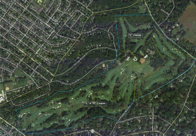
Wetlands Delineation and Individual/Joint Permit, Huntingdon Valley Country Club, C-Course Restoration, Huntingdon Valley, PA
Huntingdon Valley Country Club built the A, B and C courses based on a circa 1921 William S. Flynn design. Maintenance ceased on the "C" Course in the mid-1930s due to financial difficulties associated with The Great Depression. W&E identified and delineated the resources on the portion of Huntingdon Valley Country Club that was originally the "C" Course. Tasks included delineation of wetland boundaries and working with the restoration designer to come up with a course restoration design (including cart paths and bridges) that would be the least environmentally disruptive to the mature forest that had regrown on the "C" Course. W&E held a number of pre-application meetings with PADEP and the Corps of Engineers to obtain their input regarding the proposed restoration of the historic 9-hole course. Some concessions were made by the Club that deviated from a completely historic design and PADEP and Corps of Engineers worked with W&E to achieve as close to a complete historical restoration as possible, considering current environmental regulatory constraints.
The project involved restoring fairways in areas that had reverted to forested wetland. W&E was able to establish through use of circa 1920 aerial photographs that prior to 1927 when the courses were all built that all of the land that encompassed the C-Course was either in use as pasture or row crops. The restoration project impacted only 4.8 acres of forested wetlands. The impact was only a change in plant community from forested wetland to wetland fairway and rough. A design guiding principal was that there was to be no alteration of the the land’s natural hydrology, so that if at some time in the future golf ceased to be played there it would be able to simply undergo natural succession and reforest, because the original hydrology would be preserved. The project also had to address the presence of two Pennsylvania protected plant species, Magnolia virginiana (sweet bay magnolia) and Woodwardia areolata (netted-chain fern), both Pennsylvania listed threatened plants. After extensive negotiations with Pennsylvania’s Bureau of Forestry regarding the threatened plants, a condition was added to the Individual/Joint Permit issued for the project; that condition was to relocated a couple of netted-chain fern clumps outside of the area that was to be converted to fairway/rough. The sweet bay magnolias were not within the area that was restored but careful attention had to be paid to making sure that the design did not alter the hydrology next to the magnolias. W&E came up with an innovative approach for the cart path crossings in the wetlands, and the US ACE and PA DEP were so impressed with the approach that they decided to make it “their recommended method for crossing wetlands with cart paths.” After five (5) years of annual monitoring of the relocated netted-chain fern clumps the Club was able to document their survival and successful restablishment after being transplanted.
Wetlands Delineation and Permitting, Virginia Power Company, Clover Power Plant Ash Landfill Expansion, Clover, VA*
W&E staff delineated the wetlands and waters of the US for the proposed 43-acre expansion of an ash landfill for Virginia Power’s Clover Power Plant. The landfill area is part of an area covered by an approved Part-A Permit, however the extent of wetlands and waters of the United States were not previously evaluated within each of the permitted expansion areas. As a result, a Nationwide Permit Application was required for proposed impacts to wetlands and waters of the US within the footprint of the expansion area. An application for a Nationwide Permit was submitted to the Wilmington District of the Corps of Engineers following their concurrence with the permitting approach as discussed during an on-site meeting. The approach the Corps of Engineers agreed to was presented in an effort to avoid the need to apply for an Individual Permit, which could have cause substantial project delays, in excess of six months. The Nationwide permit was approved and issued within 45 days and the remainder of the design work was completed in time for the power plant to begin using the new ash disposal area right after the currently operating landfill area had reached its design capacity.
W&E staff delineated the wetlands and waters of the US for the proposed 43-acre expansion of an ash landfill for Virginia Power’s Clover Power Plant. The landfill area is part of an area covered by an approved Part-A Permit, however the extent of wetlands and waters of the United States were not previously evaluated within each of the permitted expansion areas. As a result, a Nationwide Permit Application was required for proposed impacts to wetlands and waters of the US within the footprint of the expansion area. An application for a Nationwide Permit was submitted to the Wilmington District of the Corps of Engineers following their concurrence with the permitting approach as discussed during an on-site meeting. The approach the Corps of Engineers agreed to was presented in an effort to avoid the need to apply for an Individual Permit, which could have cause substantial project delays, in excess of six months. The Nationwide permit was approved and issued within 45 days and the remainder of the design work was completed in time for the power plant to begin using the new ash disposal area right after the currently operating landfill area had reached its design capacity.
Wetlands Functional Assessment
Replacement Wetlands Design, Confidential PRP Group, Dorney Road Superfund Site, Macungie, PA
The USEPA/Corps of Engineers determined that there were seven acres of wetlands on top of the Dorney Road landfill on the Dorney Road Superfund Site in Macungie, PA. The Record of Decision for the Superfund Site required the replacement of the seven acres of wetlands off the landfill. W&E staff designed the replacement wetlands. A significant challenge to the design was the land made available for the replacement wetlands. The land was adjacent to the capped and closed landfill, no natural wetlands or surface water exists within five miles of the site and the depth to shallow groundwater is more than 30 feet below the existing ground surface. To develop the design a semi-quantitative assessment of the values and functions was performed for the existing wetlands on top of the landfill, using Wetlands Evaluation Technique (WET). Based on the results of the WET, a conceptual design was developed for seven acres of replacement wetlands. To evaluate the design, W&E staff performed a comparative evaluation of the 30% replacement wetland design to the impacted wetland using Wetland Replacement Evaluation Procedure (WREP). The preliminary (30%), intermediate (60%), pre-final (90%), and final design (100%) phases for the replacement wetland were completed sequentially and each design deliverable met with PADEP, USACE, USFWS, and USEPA Region III approval without significant comment. The final design deliverable included a detailed design, planting plans, an operation and maintenance plan, a 5-year performance-monitoring plan, and specifications. The final design was approved in early 1995 without further comment and construction was completed in early 2001.
The USEPA/Corps of Engineers determined that there were seven acres of wetlands on top of the Dorney Road landfill on the Dorney Road Superfund Site in Macungie, PA. The Record of Decision for the Superfund Site required the replacement of the seven acres of wetlands off the landfill. W&E staff designed the replacement wetlands. A significant challenge to the design was the land made available for the replacement wetlands. The land was adjacent to the capped and closed landfill, no natural wetlands or surface water exists within five miles of the site and the depth to shallow groundwater is more than 30 feet below the existing ground surface. To develop the design a semi-quantitative assessment of the values and functions was performed for the existing wetlands on top of the landfill, using Wetlands Evaluation Technique (WET). Based on the results of the WET, a conceptual design was developed for seven acres of replacement wetlands. To evaluate the design, W&E staff performed a comparative evaluation of the 30% replacement wetland design to the impacted wetland using Wetland Replacement Evaluation Procedure (WREP). The preliminary (30%), intermediate (60%), pre-final (90%), and final design (100%) phases for the replacement wetland were completed sequentially and each design deliverable met with PADEP, USACE, USFWS, and USEPA Region III approval without significant comment. The final design deliverable included a detailed design, planting plans, an operation and maintenance plan, a 5-year performance-monitoring plan, and specifications. The final design was approved in early 1995 without further comment and construction was completed in early 2001.

Ecological Restoration
Wetland Restoration Design, U.S. Army Corps of
Engineers, Old Place Creek Wetlands, Staten Island, NY*
W&E staff were the project designer responsible for preparing a final design, specifications, and MCACES (cost estimate) for the restoration of a degraded tidal marsh owned by NYSDEC located along Old Place Creek on Staten Island in Richmond County, NY. The property encompasses approximately 24 acres and is composed of 4 parcels. The final design was prepared for Parcel D, an approximately five acre area. The project included an environmental/ecological survey to select biological benchmarks for setting the design elevation to achieve a Spartina alterniflora tidal marsh. At the time the biological benchmark survey was performed the vegetation currently growing on Parcel Dwas also characterized to guide the design. A small patch of upland forest was found on part of the parcel that the project designer determined should be preserved to maintain some small amount of habitat diversity on Parcel D. The information collected during the survey were used in combination with new site topography to develop the marsh restoration plans. The restoration design package that was prepared included a grading plan, a planting plan, new/restored creek channel cross-sections and profiles, and soil erosion and sediment control details. Detailed specifications were also prepared for the Corps of Engineers so that they could solicit bids for execution of the restoration design.
W&E staff were the project designer responsible for preparing a final design, specifications, and MCACES (cost estimate) for the restoration of a degraded tidal marsh owned by NYSDEC located along Old Place Creek on Staten Island in Richmond County, NY. The property encompasses approximately 24 acres and is composed of 4 parcels. The final design was prepared for Parcel D, an approximately five acre area. The project included an environmental/ecological survey to select biological benchmarks for setting the design elevation to achieve a Spartina alterniflora tidal marsh. At the time the biological benchmark survey was performed the vegetation currently growing on Parcel Dwas also characterized to guide the design. A small patch of upland forest was found on part of the parcel that the project designer determined should be preserved to maintain some small amount of habitat diversity on Parcel D. The information collected during the survey were used in combination with new site topography to develop the marsh restoration plans. The restoration design package that was prepared included a grading plan, a planting plan, new/restored creek channel cross-sections and profiles, and soil erosion and sediment control details. Detailed specifications were also prepared for the Corps of Engineers so that they could solicit bids for execution of the restoration design.
Natural Resource Banking
Lender's/Owner's Representative, EnviroFinance Group, LLC., Richard P. Kane Wetlands Mitigation Bank, Moonachie, NJ*
W&E staff was previously retained by EnviroFinance Group LLC (EFG), to conduct a comprehensive due diligence review of the design, specifications, permit documents, etc. for the Richard P. Kane Wetlands Mitigation Bank. The due diligence review included an update to the market analysis that was prepared for the mitigation bank was performed at the request of EFG. The market analysis was used to assess potential projects that would create demand for wetland credits and estimate when those credits would be needed by a particular project. The market analysis was a critical component of the due diligence review because only public transportation projects were permitted to purchase credits from the mitigation bank.
A number of winter storms in early 2011 damaged portions of the project and staff at W&E were previously retained by EFG to facilitate emergency repairs to the roadway that traverses the tidal marsh and covers an important high pressure natural gas pipeline. Two back-to-back storm events caused major breaches that had to be repaired, and it became apparent that a third breach was likely to occur during the King Tides predicted to occur in early May. In consultation with the design engineer for the mitigation bank the roadway height was increased so that it would be a few inches above the King Tides to prevent any further breaches from occurring. The elevation of the roadway had to be completed within a very tight time schedule.
W&E staff was retained by EFG to represent their interests as the lenders financing the construction of the mitigation bank. Construction of the mitigation bank was nearly complete when Hurricane Irene caused significant damage. EFG became the owners of the mitigation bank and continued to finance the repair and completion of the mitigation bank. Staff at W&E were previously retained by EFG to act on their behalf as lender's/owner's representative, attending the weekly construction meetings and providing review and comment on various contracts and construction issues as they arose. Weekly reports were provided to the lender/owner regarding construction progress. All repairs and construction were completed less three months before Hurricane Sandy caused major damage to the mitigation bank. During the 2013 construction season, the repairs from the damage caused by Hurricane Sandy were completed and staff at W&E were previously retained as owner's representative for EFG. Every time repairs were required, the restored tidal marsh had to be blocked off from tidal influence and dewatered. W&E staff was later retained by EFG to act on their behalf as lender's/owner's representative, attended weekly construction meetings and providing review and comment on various contracts and construction issues as they arose. Weekly reports are provided to the lender/owner regarding construction progress.
Natural Resource Valuation, Confidential Client, Former Maine Electronics Facility, Lisbon, ME
A confidential client purchased the environmental liability for the former Maine Electronics Facility. The client needed to assess the value of the land as an offset for the Natural Resources Damages Assessment that the state had levied against Maine Electronics. W&E staff contracted and oversaw the delineation of all of the wetlands boundaries on the nearly 200 acre property owned by the client. While overseeing the delineation work W&E staff collected information regarding the values and functions performed by those wetlands using a variety of methods. Using the results of the wetlands delineation and our functional assessment of the wetlands and other habitats on the property W&E staff assisted in development of a valuation for the ecological resources on the property. The valuation took into account unique habitats, types of plant communities present and the plant species identified on the property. An inventory of resources and assignment of the relative value for those resources was prepared for negotiating the trade of some of the natural resource assets on the property to the state in lieu of reimbursement to settle the assessed damages claim.
A confidential client purchased the environmental liability for the former Maine Electronics Facility. The client needed to assess the value of the land as an offset for the Natural Resources Damages Assessment that the state had levied against Maine Electronics. W&E staff contracted and oversaw the delineation of all of the wetlands boundaries on the nearly 200 acre property owned by the client. While overseeing the delineation work W&E staff collected information regarding the values and functions performed by those wetlands using a variety of methods. Using the results of the wetlands delineation and our functional assessment of the wetlands and other habitats on the property W&E staff assisted in development of a valuation for the ecological resources on the property. The valuation took into account unique habitats, types of plant communities present and the plant species identified on the property. An inventory of resources and assignment of the relative value for those resources was prepared for negotiating the trade of some of the natural resource assets on the property to the state in lieu of reimbursement to settle the assessed damages claim.
Environmental Permitting
Individual/Joint Permit for New Store, Giant Food Stores, Middletown, PA
W&E staff applied for and obtained an Individual/Joint Permit from PADEP and the Corps of Engineers for filling 0.96 acre of forested wetland for the construction of a new Giant Food Store in Middletown Township, Bucks County, PA. The application included 1.92 acres of replacement wetlands at both on-site and off-site locations. During the design of the replacement wetlands, W&E staff performed a functions and values assessment of the wetlands, both those to be impacted by the proposed new store and the design for the replacement wetlands, using Wetlands Evaluation Technique (WET) and Wetland Replacement Evaluation Procedure (WREP). The replacement wetlands were proposed for the off-site location within a park area owned by Bristol Township and as proposed would replace more than the values and functions than the existing wetlands had, in addition to providing some additional flood storage capacity within the watershed.
W&E staff applied for and obtained an Individual/Joint Permit from PADEP and the Corps of Engineers for filling 0.96 acre of forested wetland for the construction of a new Giant Food Store in Middletown Township, Bucks County, PA. The application included 1.92 acres of replacement wetlands at both on-site and off-site locations. During the design of the replacement wetlands, W&E staff performed a functions and values assessment of the wetlands, both those to be impacted by the proposed new store and the design for the replacement wetlands, using Wetlands Evaluation Technique (WET) and Wetland Replacement Evaluation Procedure (WREP). The replacement wetlands were proposed for the off-site location within a park area owned by Bristol Township and as proposed would replace more than the values and functions than the existing wetlands had, in addition to providing some additional flood storage capacity within the watershed.
Replacement Wetlands Design and Permitting, Dames & Moore Inc., Motiva-Hazardous Waste Landfill and Former Land Treatment Unit Closure, Delaware City, DE
DNREC determined that the closed and remediated former Land Treatment Unit (LTU) at Motiva's Delaware City Refinery had to be capped to provide two feet of cover over the remediated soils. Dames & Moore identified an adjacent, unused land area as a source for the soil needed to cover the former LTU. W&E delineated the boundaries of the wetland and waters of the US on the identified soil source land. Because wetlands were present on the soil borrow source the wetlands and waters on the land would be disturbed. W&E prepared an application and obtained Nationwide Permit (No. 26) for disturbing/excavating 2.7 acres of wetlands on the borrow area. The project as proposed involved excavating 2.7-acres of low quality wetland so that the soil under the wetland could be used for soil cover material for the LTU. The Nationwide Permit application contained a Wetland Compensation Plan that replaced the 2.7-acres of low quality wetland with 4.7-acres of diverse, high quality wetlands. The final phase of the project included building a “Links” style golf course on the soil borrow area, so W&E incorporated the replacement wetlands as part of the design for the course and they became a "water hazard” on the course. W&E prepared detailed specifications for the replacement wetlands and a performance-monitoring plan that were submitted with the permit application, The application was reviewed by the Corps of Engineers and approved without comment.
DNREC determined that the closed and remediated former Land Treatment Unit (LTU) at Motiva's Delaware City Refinery had to be capped to provide two feet of cover over the remediated soils. Dames & Moore identified an adjacent, unused land area as a source for the soil needed to cover the former LTU. W&E delineated the boundaries of the wetland and waters of the US on the identified soil source land. Because wetlands were present on the soil borrow source the wetlands and waters on the land would be disturbed. W&E prepared an application and obtained Nationwide Permit (No. 26) for disturbing/excavating 2.7 acres of wetlands on the borrow area. The project as proposed involved excavating 2.7-acres of low quality wetland so that the soil under the wetland could be used for soil cover material for the LTU. The Nationwide Permit application contained a Wetland Compensation Plan that replaced the 2.7-acres of low quality wetland with 4.7-acres of diverse, high quality wetlands. The final phase of the project included building a “Links” style golf course on the soil borrow area, so W&E incorporated the replacement wetlands as part of the design for the course and they became a "water hazard” on the course. W&E prepared detailed specifications for the replacement wetlands and a performance-monitoring plan that were submitted with the permit application, The application was reviewed by the Corps of Engineers and approved without comment.
Waterfront Development and Nationwide Permits, Construction & Marine Equipment Co., Inc., Bulkhead and Dock Expansion, Elizabeth, NJ
W&E prepared the application for and obtained a NJDEP Waterfront Development Permit and a US Army Corps of Engineers Nationwide Permit, for construction of a new 750 foot bulkhead and dock at Construction & Marine Equipment Company, Inc.’s facility. The project involved applying for a Waterfront Development Permit for the replacement of the existing bulkhead approximately 35 feet waterward of the existing bulkhead in the Arthur Kill and the reconstruction of the dock. To have a complete application for NJDEP to review, an outstanding tidelands issue had to be resolved with the previous land owner. The fill placed in the tidal waters was mitigated for by purchasing wetland mitigation credits at a local bank, because there was no opportunity to create wetlands on the property. This project involved extensive negotiations with NJDEP to justify the filling of tidal waters; there was minimal involvement on the part of the Corps of Engineers. The Corps of Engineers did however, require an Essential Fish Habitat assessment to be performed prior to issuing the Nationwide Permit.
W&E prepared the application for and obtained a NJDEP Waterfront Development Permit and a US Army Corps of Engineers Nationwide Permit, for construction of a new 750 foot bulkhead and dock at Construction & Marine Equipment Company, Inc.’s facility. The project involved applying for a Waterfront Development Permit for the replacement of the existing bulkhead approximately 35 feet waterward of the existing bulkhead in the Arthur Kill and the reconstruction of the dock. To have a complete application for NJDEP to review, an outstanding tidelands issue had to be resolved with the previous land owner. The fill placed in the tidal waters was mitigated for by purchasing wetland mitigation credits at a local bank, because there was no opportunity to create wetlands on the property. This project involved extensive negotiations with NJDEP to justify the filling of tidal waters; there was minimal involvement on the part of the Corps of Engineers. The Corps of Engineers did however, require an Essential Fish Habitat assessment to be performed prior to issuing the Nationwide Permit.
Dredge Material Management

Maintenance Dredging, TOSCO Refinery, Trainer, PA
W&E prepared the sediment sampling and analysis plan, conducted the sampling, evaluated and summarized the analytical results, and applied for and obtained a Water Quality Certificate from NJDEP’s Office of Dredging and Sediment Technology, for TOSCO Refinery’s maintenance dredge. Following NJDEP’s approval of the sampling and analysis plan, W&E provided sediment sampling oversight and laboratory coordination. The sediment analyses included the normal NJDEP's bulk sediment analytical testing and PCB congener analysis because the facility is located on the Delaware River. Following receipt of the analytical data, W&E evaluated and summarized the results as part of the Water Quality Certificate/Permit application, for the dredging and disposal of about 107,000 cubic yards of sediment from the Delaware River. W&E was able to obtain the permit in a timely manner, which allowed the Refinery to continue operations without interruption.
W&E prepared the sediment sampling and analysis plan, conducted the sampling, evaluated and summarized the analytical results, and applied for and obtained a Water Quality Certificate from NJDEP’s Office of Dredging and Sediment Technology, for TOSCO Refinery’s maintenance dredge. Following NJDEP’s approval of the sampling and analysis plan, W&E provided sediment sampling oversight and laboratory coordination. The sediment analyses included the normal NJDEP's bulk sediment analytical testing and PCB congener analysis because the facility is located on the Delaware River. Following receipt of the analytical data, W&E evaluated and summarized the results as part of the Water Quality Certificate/Permit application, for the dredging and disposal of about 107,000 cubic yards of sediment from the Delaware River. W&E was able to obtain the permit in a timely manner, which allowed the Refinery to continue operations without interruption.
Berth Deepening, Construction & Marine Equipment Company, Inc., Elizabeth, NJ*
Construction & Marine Equipment Company (CMEC) operates a marine construction facility on the Arthur Kill in Elizabeth, NJ and their existing berth was approximately 18 feet deep and needed to be deepened to approximately -30 feet MSL to accommodate a larger class of ship in need of repairs or outfitting. W&E staff collected sediment samples, perform analytical testing, and prepare a data summary report in support of the application CMEC had filed for deepening their berth to -30 feet MSL.The sampling included collecting sediment cores up to 18 feet below the bottom of the Arthur Kill and analyzing those sediment samples for VOCs, SVOCs, PCBs, pesticides, metals, dioxins and furans. In addition to the bulk sediment analyses required by NJDEP, analytical testing for the same parameters was performed on the same sediment after it was mixed Portland cement a potential dewatering material to ascertain whether it would be of sufficient quality to be disposed of at a land based facility.
Construction & Marine Equipment Company (CMEC) operates a marine construction facility on the Arthur Kill in Elizabeth, NJ and their existing berth was approximately 18 feet deep and needed to be deepened to approximately -30 feet MSL to accommodate a larger class of ship in need of repairs or outfitting. W&E staff collected sediment samples, perform analytical testing, and prepare a data summary report in support of the application CMEC had filed for deepening their berth to -30 feet MSL.The sampling included collecting sediment cores up to 18 feet below the bottom of the Arthur Kill and analyzing those sediment samples for VOCs, SVOCs, PCBs, pesticides, metals, dioxins and furans. In addition to the bulk sediment analyses required by NJDEP, analytical testing for the same parameters was performed on the same sediment after it was mixed Portland cement a potential dewatering material to ascertain whether it would be of sufficient quality to be disposed of at a land based facility.
Maintenance Dredging, Borough of Point Pleasant, Beaver Creek, Borough of Point Pleasant, NJ
W&E staff prepared the design specifications for the dredging, dewatering and disposal of approximately 2,200 CY of sediment from Metedeconk River north of Barnegat Bay. A number of dewatering options were provided in the design specifications to afford options for the dredging contractors bidding on the work. The dewatering site, which was leased from a local community, had to be restored prior to the beginning of the “summer tourist season” and there were dredge-timing restrictions due to winter flounder breeding habitat in the area. The disposal site selected for the dewatered sediment was a former sand-mining pit about 10 miles from the dewatering site. The combination of the winter flounder restriction and short time window allotted by a local homeowner’s association for completing the project had to be carefully managed so that none of the dredging and dewatering restrictions imposed were exceeded. As part of the application for the maintenance dredge permit, the sediment was sampled and analytical results were used by W&E staff to determine whether it was sufficiently clean to be placed in the former sand pit.
W&E staff prepared the design specifications for the dredging, dewatering and disposal of approximately 2,200 CY of sediment from Metedeconk River north of Barnegat Bay. A number of dewatering options were provided in the design specifications to afford options for the dredging contractors bidding on the work. The dewatering site, which was leased from a local community, had to be restored prior to the beginning of the “summer tourist season” and there were dredge-timing restrictions due to winter flounder breeding habitat in the area. The disposal site selected for the dewatered sediment was a former sand-mining pit about 10 miles from the dewatering site. The combination of the winter flounder restriction and short time window allotted by a local homeowner’s association for completing the project had to be carefully managed so that none of the dredging and dewatering restrictions imposed were exceeded. As part of the application for the maintenance dredge permit, the sediment was sampled and analytical results were used by W&E staff to determine whether it was sufficiently clean to be placed in the former sand pit.
Environmental Assessment and Environmental Impact Statement
Environmental Assessment, Pittsburgh International Airport, Proposed Commercial Development of Land Owned by the Airport, Pittsburgh, PA
W&E staff worked on an Environmental Assessment (EA) was required for the proposed development of numerous commercial properties on the land owned by the Pittsburgh International Airport (PIA). W&E staff prepared the sections of the EA that related to water quality, wetlands, and biological resources for each of the six proposed major developments (including a proposed indoor NASCAR track). Work included on-site habitat assessments, assessment of data regarding natural resources that were present on each of the parcels and an evaluated the potential impacts to those resources associated with the proposed development projects. Write-ups were prepared that explored and assessed available alternatives that would potentially minimize impacts and a written discussed was prepared regarding mitigation options for any unavoidable impacts from those projects.
W&E staff worked on an Environmental Assessment (EA) was required for the proposed development of numerous commercial properties on the land owned by the Pittsburgh International Airport (PIA). W&E staff prepared the sections of the EA that related to water quality, wetlands, and biological resources for each of the six proposed major developments (including a proposed indoor NASCAR track). Work included on-site habitat assessments, assessment of data regarding natural resources that were present on each of the parcels and an evaluated the potential impacts to those resources associated with the proposed development projects. Write-ups were prepared that explored and assessed available alternatives that would potentially minimize impacts and a written discussed was prepared regarding mitigation options for any unavoidable impacts from those projects.
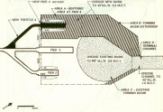
Environmental Impact Statement, US Navy, Naval Weapons Station Earle, Colts Neck, NJ
W&E staff worked on the Supplemental Draft Environmental Impact Statement (SDEIS) that was required for the US Navy to assess the potential environmental impacts associated with home-porting two Auxiliary Oil and Explosives ships at Naval Weapon Station Earle. The original Draft EIS evaluated disposal options for 8.2-million cubic yards of dredge material and the Supplemental Draft EIS included the evaluation of additional dredge material disposal options and the siting of the Ship Fuel Replenishment System (SFRS) for storing 8,400,000 gallons of diesel marine fuel and 4,200,000 gallons of JP5 jet fuel. As part of assessing potential environmental impacts, the project team performed wetland delineations and field reconnaissances of potential sites for the SFRS and field reconnaissances of additional dredge material disposal sites along with addressing the comments that were received on the Draft Environmental Impact Statement (related to dredging), all for the preparation of a Final Environmental Impact Statement.
Shortly before the release of the SDEIS, the Navy found that their two mile long trestle was in need of replacement, as a result the SDEIS was not released but efforts were turned to preparing a new EIS for the replacement of the trestle. Staff at W&E worked on the EIS for the trestle replacement.
Habitat Studies
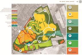
Natural Resources Management Plan, Andropogon Associates, LTD, The Lawrenceville School, Lawrenceville, NJ
W&E conducted a comprehensive assessment of the habitats on the 700+ acres of land owned by The Lawrenceville School for Andropogon Associates, Inc. The work W&E conducted was in support of The Green Campus Initiative. The habitats were identified by conducting a number of site reconnaissances and mapped using aerial photography. The habitat types on the 700+ acres included open water, wetlands (emergent, scrub/shrub and forested), meadows, forests and managed land (farmland and golf course). W&E delineated the approximate limits of wetland areas identified; characterized the plant communities in all of the habitat types we identified; identified the various non-native invasive plants throughout the property, and identified potential locations for outdoor classrooms where there were interesting habitats and potential restoration projects that could be studied as part of the science curriculum. The scope of work included developing conceptual designs for addressing flooding and managing stormwater runoff from the nearly 200 year old buildings on the campus.
W&E conducted a comprehensive assessment of the habitats on the 700+ acres of land owned by The Lawrenceville School for Andropogon Associates, Inc. The work W&E conducted was in support of The Green Campus Initiative. The habitats were identified by conducting a number of site reconnaissances and mapped using aerial photography. The habitat types on the 700+ acres included open water, wetlands (emergent, scrub/shrub and forested), meadows, forests and managed land (farmland and golf course). W&E delineated the approximate limits of wetland areas identified; characterized the plant communities in all of the habitat types we identified; identified the various non-native invasive plants throughout the property, and identified potential locations for outdoor classrooms where there were interesting habitats and potential restoration projects that could be studied as part of the science curriculum. The scope of work included developing conceptual designs for addressing flooding and managing stormwater runoff from the nearly 200 year old buildings on the campus.
Threatened and Endangered Species
Survey for Listed Species, Freehand, H.G., Independence Townhouse Subdivision, Bethel Township, PA
W&E performed four seasons of surveys for the following plant species: Aletris farinosa (colic-root), Eupatorium rotundifolium (round-leaved eupatorium), Juncus biflorus (grass rush), Juncus dichotomus (forked rush), Lespedeza angustifolia (narrow-leaved bush-clover), Lobelia puberula (downy lobelia), Amelanchier canadensis (serviceberry), Gentiana saponaria (soapwort gentian), Oxypolis rigidior (cowbane), Panicum scoparium (velvety panic grass), Polygala cruciata (cross-leaved milkwort), Spiranthes vernalis (spring ladies’-tresses), and Tipularia discolor (crane-fly orchid). None of the listed species were identified on the property, while they are known from the area. The results of the surveys were accepted by Pennsylvania Bureau of Forestry without comment or need for additional surveys.
W&E performed four seasons of surveys for the following plant species: Aletris farinosa (colic-root), Eupatorium rotundifolium (round-leaved eupatorium), Juncus biflorus (grass rush), Juncus dichotomus (forked rush), Lespedeza angustifolia (narrow-leaved bush-clover), Lobelia puberula (downy lobelia), Amelanchier canadensis (serviceberry), Gentiana saponaria (soapwort gentian), Oxypolis rigidior (cowbane), Panicum scoparium (velvety panic grass), Polygala cruciata (cross-leaved milkwort), Spiranthes vernalis (spring ladies’-tresses), and Tipularia discolor (crane-fly orchid). None of the listed species were identified on the property, while they are known from the area. The results of the surveys were accepted by Pennsylvania Bureau of Forestry without comment or need for additional surveys.
Plant Community Survey, Pets United, Inc., Proposed Expansion of Facility, Hazel Township, Luzern County, PA
W&E performed a detailed site survey to determine whether a “Ridgetop dwarf-tree forest plant community” was present on the site. The survey was performed for the following plant species: Quercus ilicifolia (bear oak), Kalmia latifolia (mountain laurel), and Pinus rigida (pitch pine). The habitat on the property had been altered in the past and had changed to an open canopy with Carex spp. (sedges), Vaccinium angustifolium (low-bush blueberry), and Comptonia peregrina (sweet fern), thus there was no ridgetop dwarf-tree forest plant community present on the site. The results of the survey were accepted by Pennsylvania Bureau of Forestry without comment.
W&E performed a detailed site survey to determine whether a “Ridgetop dwarf-tree forest plant community” was present on the site. The survey was performed for the following plant species: Quercus ilicifolia (bear oak), Kalmia latifolia (mountain laurel), and Pinus rigida (pitch pine). The habitat on the property had been altered in the past and had changed to an open canopy with Carex spp. (sedges), Vaccinium angustifolium (low-bush blueberry), and Comptonia peregrina (sweet fern), thus there was no ridgetop dwarf-tree forest plant community present on the site. The results of the survey were accepted by Pennsylvania Bureau of Forestry without comment.
*- Work completed by W&E staff prior to joining W&E
For further information contact us at info@wetlandsandecology.com